Summer 2026
Ariticle and photos by Ron Brooks
Reading an article about saltwater fishing in Georgia generally means learning about catches either offshore or around Brunswick or Savannah. Not that that’s a bad thing, but there are a lot more places to fish along the coast than just those two or three locations.
McIntosh County’s inshore fishing area runs from the Altamaha River on its southern border to the South Newport River on its northern border. The area encompasses miles and miles of untouched, pristine rivers, creeks, and marshes. There is probably more fishable inshore water here than in any of the four other coastal Georgia counties.
Sapelo Island acts as a buffer – after all, it is a barrier island – to protect the inshore waters. That allows anglers to fish in almost any weather. Any fishing can be great in almost any weather.
We made a trip to identify some easy-to-find fishing locations in McIntosh County and the area around Darien. We wanted to make sure you can catch fish at these locations, so we recorded their GPS coordinates to help you get to the same places we fished.
We started our trip from the public boat ramp in Darien. There is another ramp where US-17 crosses the Champney River that we use a lot, but navigating the rivers here can be tough for anglers new to the area. These rivers tend to shift, and sandbars can move almost overnight, it seems. And unlike the Darien River channel, which is well marked, the Altamaha and Champney are not. We suggest you stick to the known routes until you learn the ebb and flow of these rivers.
Location 1 – Mary Hall River W31° 22.930′ – N 81° 23.464′
We ran out the Darien River to marker 18 and turned north into the Mary Hall River. Our first stop was up the Mary Hall about a mile just after the river makes a hard bend to the east. Two smaller creeks take off from the river there, one to the east and one to the south.
The tide was about half low and still rolling out of these creeks. We positioned the boat, using our trolling motor, to a point where we could cast to the mouth of the creek that heads south. The trolling motor let us move at will, but we decided to anchor there to save the battery.
My partner fished with a Thunder Chicken float that had a three-foot leader attached. A 1/0 kahle hook on the end of the leader allowed us to hook a live shrimp through the head carefully. The small hook and relatively light leader let the shrimp swim freely and naturally. The light leader will break before the main line, allowing us to save the float when it gets hung.
I fished with what has become a staple in my tackle box – a Saltwater Assassin shad in the electric chicken color on a 3/8-ounce jighead. An alternate color that seems to work almost as well as the electric chicken is a white or pearl with a pink tail. Trout tend to favor the white at times, and I will switch colors when the bite slows.
As my partner cast the Thunder Chicken and shrimp well up into the creek mouth and let it float out with the tide, I worked behind him with the jig head, making a slow, pumping retrieve. That retrieve is a short, quick jerk, followed by five seconds of watching the line. Those five seconds let the jig head return to the bottom, giving the tail action time to work and entice a fish. The upward jerk pulls the jig off the bottom, restarting the cycle.
Mud minnows hooked through the lip on a jig head will accomplish the same thing, except that the upward jerk needs to be gentler. We also hook a live shrimp in the last joint of the tail and work him slowly back to the boat.
I should point out that in every location we fished we used the same rigs. Sometimes we both pitched live shrimp under a float, and sometimes we both pitched jigs and plastic. But these are the basic rigs we fished.
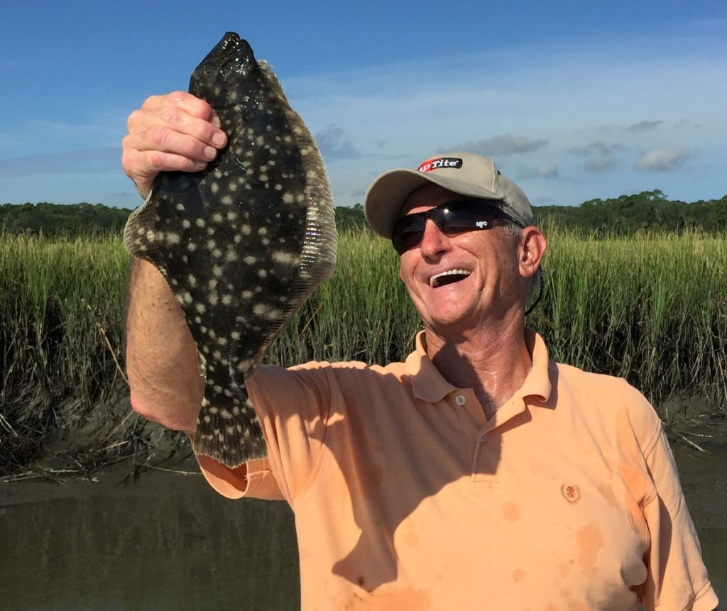
There was one nice flounder in the mouth of this creek, and he hit the electric chicken as I worked it up and down from the bottom.
We similarly worked the other creek and caught one or two very small redfish.
Location 2 – Dead River W 31°25.083′ – N 81°21.796′
Don’t let the name fool you. This river that connects from the upper reaches of the Mary Hall back out to the ICW via the Folly River is far from dead. It is a deep river and can be safely run all the way through at high tide. At low tide, you may find a bar or two on the upper reaches.
We fished another creek mouth, the first one on the right as you enter the river. We used the same setup and found a few fish coming out of the creek as the tide headed toward low tide.
When the tide stopped running, we headed farther into the river, looking for deep holes. Many creeks and rivers in this area have some really good holes. In cold weather, when the water temperature drops, fish will drop into these holes and sit, looking for warmer water on the bottom.
On one outside bend in the river, we found the water depth to be 24 feet at dead low tide. We also marked fish on the bottom, so we quietly punched the bow of the boat into the mud marsh on the inside bend. Fishing from the back of the boat, we put an eight-foot leader under that Thunder Chicken and allowed a live shrimp to swim freely.
While a rig like that is difficult to cast, it can be mastered within a few tries.
We cast the baits up current, into the now-incoming tide, and allowed the shrimp to make its way into and through the deep hole. It didn’t take long for a nice trout to inhale the shrimp. We sat right there and caught trout as fast as we could get a bait back into that hole.
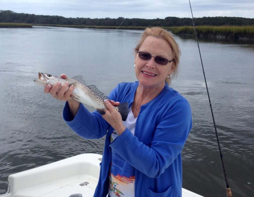
Donna Jeanne Brooks with a McIntosh County seatrout.
I have not provided a GPS location for this particular hole because, a day later, we went back and there were no fish in it. They had moved to another deep spot in Dead River. The trick is to try each deep hole until you locate the fish. They are all located on the outside bends in the river. Once you locate them, sit back and catch!
Location 3 – Folly River Head W 31°24.776′ – N 81°19.995′
As the tide began to move in, we followed Dead River into its junction with the Folly River. We followed the tide into the Folly and went to the GPS numbers above. At these numbers, we turned right into an opening, then right again into a small creek that heads south. At this point, silence is a must. This is a small, shallow creek that we use on an incoming tide, and noises from your boat will spook fish coming into the creek. A hundred yards back into this creek, we nudged into the mud bank on an inside bend and waited for the water to settle.
This creek feeds and is fed by the surrounding marsh. Once again, we used a short Thunder Chicken rig and a jig head with an electric chicken tail, and once again we caught several small redfish.
Location 4 – Todd River W 31°33.541′ – N 81°12.939′
The Todd River runs out of the marsh and empties into Sapelo Sound. It is a relatively deep creek and can be fished all the way down to low tide with no problem. The deep water extends far back into the creek, and there are several feeder creeks that you can choose from to fish.
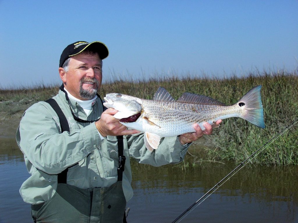
Capt. Mark Noble With a good inshore redfish.
As in other creeks, the outside of the bends in the river are where the deepest water will be found. We fished several of the feeder creeks far into the north prong of the river, using the same methods and baits. The results were not as good here as at other locations, but we did manage to catch a couple of flounder.
Location 5 – Blackbeard Creek W 31°31.551′ – N 81°12.929′
Blackbeard Creek just might be one of the best fishing spots in McIntosh County – in my humble opinion! I have really seen a lot of fish come out of this creek and heard numerous reports of good catches.
The GPS numbers mark the entrance to the creek on the northwest corner of Sapelo Island. Actually, the creek cuts the island into two parts. It runs south and across the island and exits into the ocean on the southeast corner.
If you plan to head into the creek, head first for the northern tip of Sapelo and then run south along the shoreline next to the marsh. A deep channel runs there, leading you right into the creek.
You can run this creek at low tide if you make sure you stay close to the outside bends. The water shoals and shallows on the inside of the turns. One word to the wise: There is a ranger station dock in the creek, and it is a no-wake zone past the dock. Take it from me – they will stop you if you are not idling!
Fish this creek like the others we have located. Look for small feeder creeks and run-outs and fish the outgoing tide at the mouth of those locations. At dead low tide, you can move back into several of the feeder creeks. Just make sure you do it quietly. Poling would be a good option.
When the tide begins to come in, place your shrimp and float in the water ahead of an outside bend and let it move through the bend. If the fish are there, they will eat your bait before it gets out of the bend.
Just before Blackbeard reaches the ocean on the east side of Sapelo Island, there is a small, sandy beach in a wide part of the creek. On an outgoing tide, flounder like to lie up in this sand. Jigs tipped with mud minnows or electric chicken grubs will usually attract more than one flounder.
Across the creek to the west, Cabretta Creek takes off to the south. This creek is a hit or miss creek. If the fish are there, you can fill your limit in a hurry. If they aren’t there – and you will know it in short order – you need to move on.
There are numerous tips you need to know when fishing any of these locations. The most important is – get a chart! NOAA chart 11510 covers Sapelo and Doboy Sounds and is an excellent chart for fishing any of the locations we have outlined.
Bottom Line
In any of these locations, you need to realize that fish will react differently under different circumstances. The days we fished were relatively warm compared to most winter days in February. On warm days, the fish will move as far back into the creeks and marsh as they can, seeking shallow water that warms more quickly. When the water temperature drops several degrees after a cold front, they may not be at the back of the creeks. They may drop off to the deeper holes in bends in the creek, because the deeper water, although still cold by our standards, will be warmer than the surface water.
Also, in any of these locations, please make sure you don’t enter a creek at high tide that you may not be able to leave at low tide. Our tides can run as much as nine feet difference between high and low, and what may seem like a deep creek at high tide could leave you stranded at low tide. If you notice, we always enter the feeder creeks at low tide and fish the incoming portion. Those that we enter on high tide are the ones we have been in at low tide, and we know we can get out.
Take these locations and be prepared to modify your approach. Obviously, you can’t fish all these locations in one day. They are too far apart. Plan to fish either north or south. There are so many good creeks, you will certainly find fish in one of them.
Look for baitfish! If you see baitfish in a creek, the odds are in your favor that the creek will be holding fish. You may not find fish in the creeks we fished even though they were there the days we fished. Look for areas similar to these and do some prospecting. If you put baits in the water and get no bites in fifteen minutes, plan to move to another bend or another creek. The fish will be where you find them!
Give McIntosh County’s inshore fishing a try this summer. The fishing pressure is extremely light, and the fish are there just waiting to be caught!
Ron Brooks was a long-time resident of metro Atlanta and now living in Jacksonville, Florida. He is a member of the Georgia Outdoor Writers Association. Contact him at jbrooks@bellsouth.net.